Difference between revisions of "Map A.11 - West Greenland"
Tao alexis (talk | contribs) |
Tao alexis (talk | contribs) |
||
| Line 1: | Line 1: | ||
[[File:A.11 - West Greenland.png|760px|thumb]] | [[File:A.11 - West Greenland.png|760px|thumb]] | ||
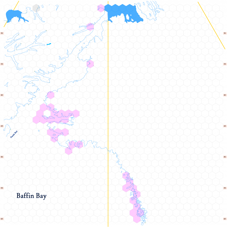
| − | Click to enlarge. Shows latitude 72.51 to 82.34 north, including the east side of [https://en.wikipedia.org/wiki/Ellesmere_Island Ellesmere Island] and the northwestern coast of [https://en.wikipedia.org/wiki/Greenland Greenland]. Parts of the map are significantly settled by [[Human Race & Physiology|human]] Inuit ~ most notable is the settlement of [https://en.wikipedia.org/wiki/Qaanaaq Thule]. [https://en.wikipedia.org/wiki/Baffin_Bay | + | Click to enlarge. Shows latitude 72.51 to 82.34 north, including the east side of [https://en.wikipedia.org/wiki/Ellesmere_Island Ellesmere Island] and the northwestern coast of [https://en.wikipedia.org/wiki/Greenland Greenland]. Parts of the map are significantly settled by [[Human Race & Physiology|human]] Inuit ~ most notable is the settlement of [https://en.wikipedia.org/wiki/Qaanaaq Thule]. [https://en.wikipedia.org/wiki/Baffin_Bay Baffin Bay], the large body of water on the left side of the map, is an important whaling region, warmed through the summer by the [https://en.wikipedia.org/wiki/North_Water_Polynya North Water polynya]. |
Revision as of 04:00, 9 March 2020
Click to enlarge. Shows latitude 72.51 to 82.34 north, including the east side of Ellesmere Island and the northwestern coast of Greenland. Parts of the map are significantly settled by human Inuit ~ most notable is the settlement of Thule. Baffin Bay, the large body of water on the left side of the map, is an important whaling region, warmed through the summer by the North Water polynya.
Orange lines indicate 150°W (top left), 120°W (center) and 90°W (top right). Thus, the top left of the map is north of Anchorage, the center is north of Calgary, while the top right is north of St. Louis. Hexes are 20 miles in diameter. Numbers on the left and right indicate distance from the North Pole in hexes.
See Also,
Sheet Maps
And from Wikipedia,
