Difference between revisions of "Map A.06 - Aryania"
Tao alexis (talk | contribs) |
Tao alexis (talk | contribs) |
||
| Line 14: | Line 14: | ||
<br> | <br> | ||
And from Wikipedia,<br> | And from Wikipedia,<br> | ||
| − | :[https://en.wikipedia.org/wiki/New_Siberian_Islands East Siberian Islands] / [https://en.wikipedia.org/wiki/Yakutia Yakutia] | + | :[https://en.wikipedia.org/wiki/New_Siberian_Islands East Siberian Islands] / [https://en.wikipedia.org/wiki/Yakutia Yakutia] / [https://en.wikipedia.org/wiki/Yana_Bay Yana Bay] |
Revision as of 21:41, 8 March 2020
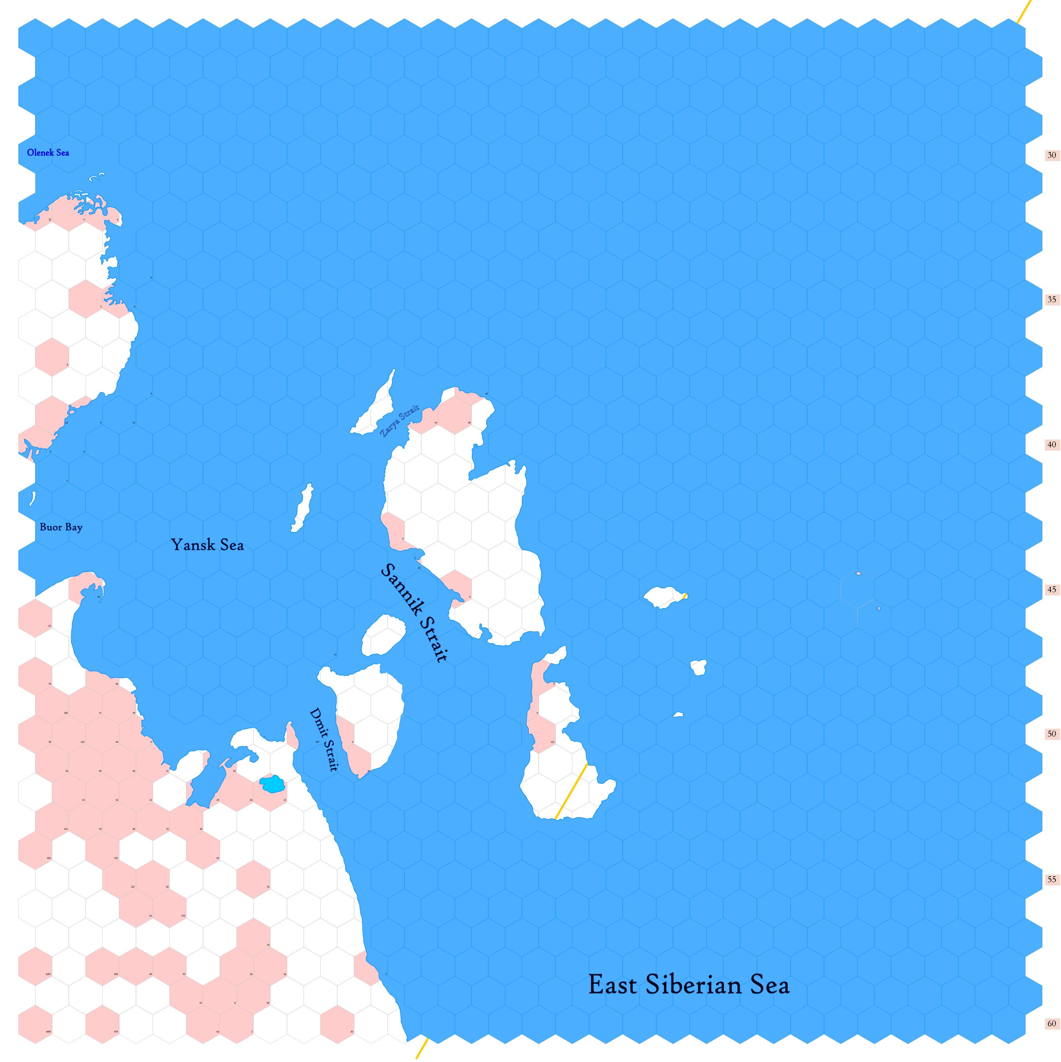
Click to enlarge. Shows latitude 72.51 to 82.34 north, including the northeastern coastline of Trakkatch Dran and the unknown islands of Laokkoy. These are bounded by the far-flung, inaccessible East Siberian Sea, a convenient modern-earth name for a map that has been little more than plotted. There remain large parts of my game world that is unmapped; and some of these are so remote that they may never be finished.
Trakkatch Dran is a land occupied by norkers.
The orange line, showing at the center bottom and top right, gives the line of hexes that indicates 150°E. Numbers at the right indicate distance from the north pole in hexes; the direction of north is at the top right, so it must be noted the direction on the map turns 60° at the 150th meridian.
See Also,
Sheet Maps
- East: Map A.07 - East Siberian Sea (sea map/no land)
- West: Laptev Sea
And from Wikipedia,
