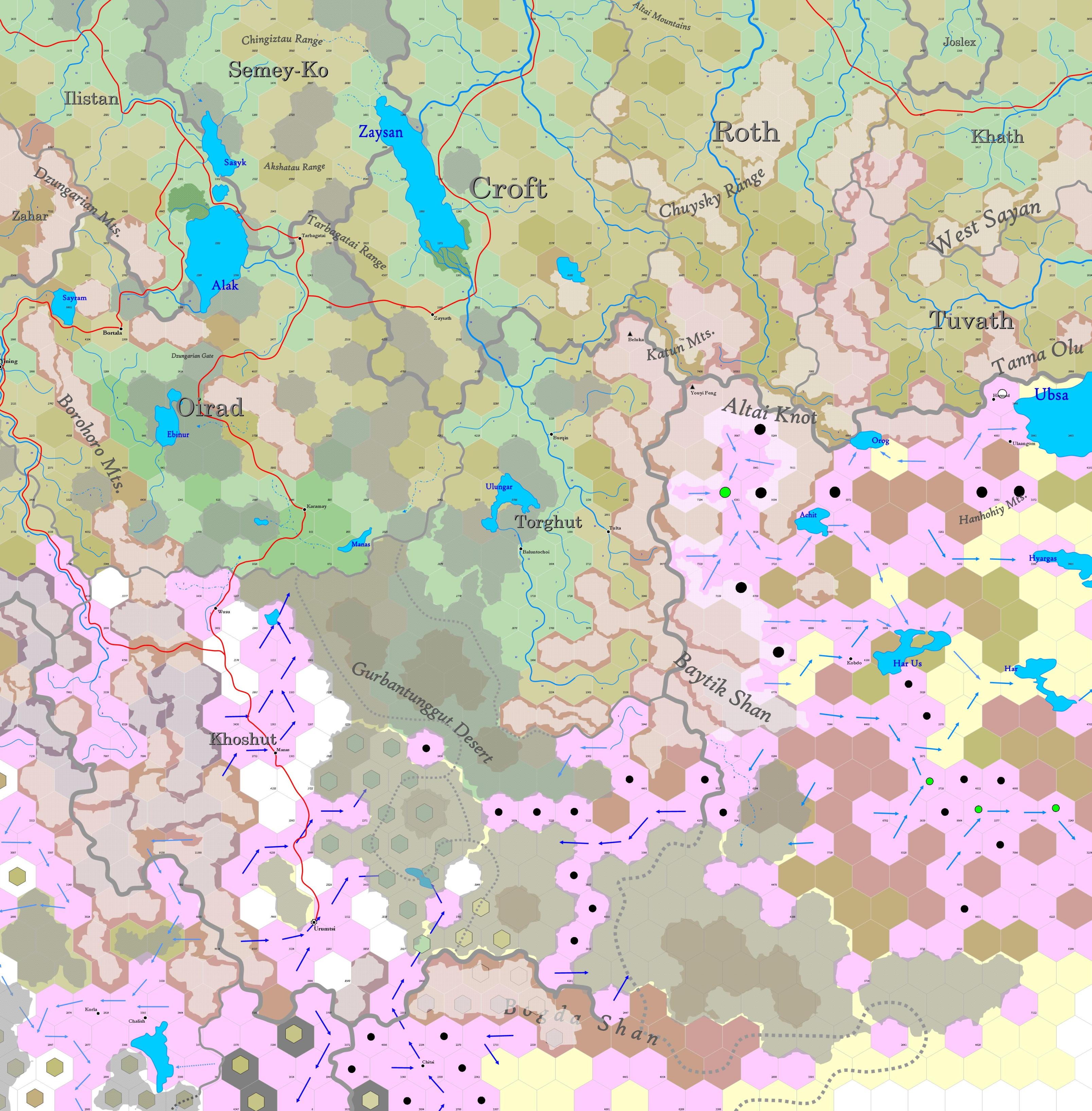
Map D.08 - Altai
Incomplete map. Labels are a convenience until further design is applied.
Contents
Mountain and desert region reaching south from 53.13°N to 43.38°N, a land of mountains, basins and arid plateaus, spanning from the windswept steppes of the north to the rocky deserts beyond the southernmost ranges.
Hexes are 20 miles in diameter. Total area depicted equals 366,450 sq.m.
Features
This part of the world includes the highlands west of the great steppes, the rugged corridors near the Dzungarian Gate and the dry lands reaching toward the Bodda Shan mountains. The Tien Shan and its outlying ridges form the backbone of this land. To the west, the Dzungarian Basin spreads in a vast, dry expanse. The lands near the Dzungarian Gate serve as a natural pass, a route where caravans and nomads have traveled for centuries, while to the east, hidden valleys and remote uplands remain sparsely inhabited, visited only by traders, hunters and warbands moving between the highlands and the lowlands. It is a land of endurance, shaped by the rhythms of wind, drought and the slow march of migration.
Tien Shan
Between the Altai Knot and the Borohoro Mountains is a rugged and expansive highland region, where glaciated peaks, deep-cut valleys and alpine meadows define the landscape. This section of the range forms a natural divide between the Dzungarian Basin to the north and the lowlands and deserts to the south, with elevations rising sharply from the surrounding terrain. The northern slopes descend toward the Dzungarian Basin, transitioning from forested foothills into dry, rocky steppe, while the southern slopes are steeper, marked by glacial valleys and fast-moving rivers that drain toward broader basins. In summer, the high-altitude meadows provide seasonal pasture for herders, while winter buries much of the range in snow, making many passes impassable.
The rivers flowing from these mountains sustain scattered settlements, hunting camps and migratory routes, though the region remains largely untamed. Its remote passes and hidden valleys have long served as corridors for nomads, traders and warbands, moving between the northern steppes and the lands beyond the Borohoro range.
Altslok
The dwarven Kingdom of Altslok is a rugged domain, hidden within the highlands and peaks that separate the Siberian forests from the arid lands of the south. It is a land of stone, deep halls and formidable isolation. The kingdom's geography spans the Altai, Sayan and Tannu-Ola mountain systems, encompassing vast highlands, deep valleys and glacial rivers. While trade routes exist, most of Altslok remains inaccessible to outsiders, its core regions fortified within the most impassable terrain.
The climate is shaped by harsh winters and fleeting summers. Snowfall is heavy, especially in Roth and Tuvath, where deep valleys trap ice and cold winds howl through mountain passes. Even in summer, much of the highlands remain frozen, making Altslok a kingdom where dwarves thrive underground rather than upon the exposed, wind-scoured peaks.
Historically, Altslok arose from the ruins of the Old Khathic Kingdom, which fell to hobgoblins after centuries of war. The survivors retreated westward, founding a new kingdom of faith and military resilience. Four haffs — Croft, Khath, Roth and Tuvath — govern Altslok's rule. Croft holds the monarchy, Khath serves as its religious heart, Roth houses its warrior legions and Tuvath endures as its last, most isolated stronghold.
