Difference between revisions of "Map A.11 - West Greenland"
From The Authentic D&D Wiki
Jump to navigationJump to searchTao alexis (talk | contribs) |
Tao alexis (talk | contribs) |
||
| (8 intermediate revisions by the same user not shown) | |||
| Line 1: | Line 1: | ||
| − | [[File:A.11 - West Greenland. | + | [[File:A.11 - West Greenland.jpg|right|680px|thumb]] |
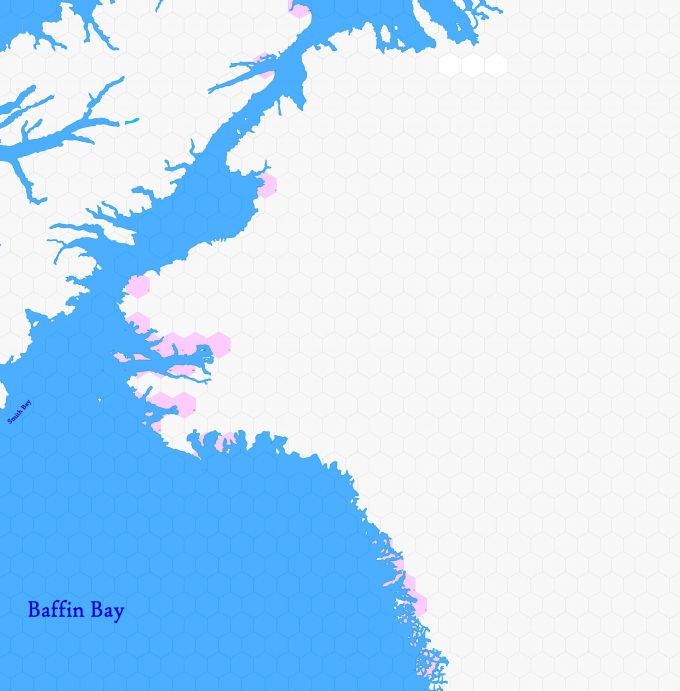
| + | '''Incomplete map'''. Arctic region reaching from 82.34°N south to 72.51°N. | ||
| − | + | Hexes are [[20-mile Hex Map|20 miles]] in diameter. Total area depicted equals 366,450 sq.m. | |
| − | + | == Adjacent Maps == | |
| − | + | {| class="wikitable" style="text-align: center; background-color:#d4f2f2;" | |
| − | + | |- | |
| − | + | ! [[Map A.10 - Bathurst|A10: Bathurst]] !! colspan="2"|[[Map A.11 - West Greenland|A11: West Greenland]] !! [[Map A.12 - High Greenland|A12: High Greenland]] | |
| − | [[ | + | |- |
| − | + | ! colspan="2"|[[Map B.15 - Baffin|B15: Baffin]] !! colspan="2"|[[Map B.16 - Nuuk Coast|B16: Nuuk Coast]] | |
| − | : | + | |} |
| − | + | ||
| + | |||
| + | See [[Sheet Maps]] | ||
Latest revision as of 01:46, 3 July 2021
Incomplete map. Arctic region reaching from 82.34°N south to 72.51°N.
Hexes are 20 miles in diameter. Total area depicted equals 366,450 sq.m.
Adjacent Maps
| A10: Bathurst | A11: West Greenland | A12: High Greenland | |
|---|---|---|---|
| B15: Baffin | B16: Nuuk Coast | ||
See Sheet Maps
