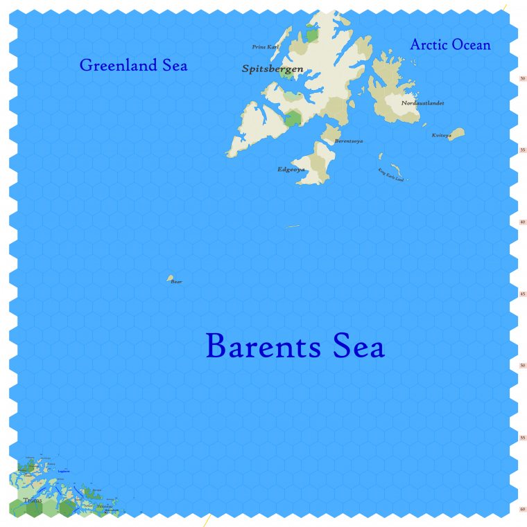
Map A.02 - East Spitsbergen
Click to enlarge. Shows latitude 72.51 to 82.34 north, including the islands of Spitsbergen, Bear Island and part of the County of Troms and the Thann of Finnemar. The wide Barents Sea, called the Devil's Dance Floor or the Devil's Jaw, dominates the map.
Troms is part of Denmark & Norway, and is inhabited by humans, but Finnemar is elvish and part of the Principality of Ulthua. That is why the real world's Hammerfest has been renamed "Hammerhearth." The elves settled it first, in 747 anno domini.
I'd be most likely to employ the map as a pathway to Svalbard, towards which the party would venture in search of obscure wisdom or perhaps seeking the wreck of a lost ship. Details of the residents on those islands are being withheld for the day when my players find a reason to go here. I've not yet had any party who spent any time on this map.
The orange line, showing at the center bottom and top right, show the line of hexes that indicates 30°E. Hexes are 20 miles in diameter. Numbers at the right indicate distance from the north pole in hexes; the direction of north is at the top right, so it must be noted the direction on the map turns 60° at the east 30th meridian.
See Also,
Sheet Maps
- East: Jotunheim
- West: Greenland Sea
And from Wikipedia:
