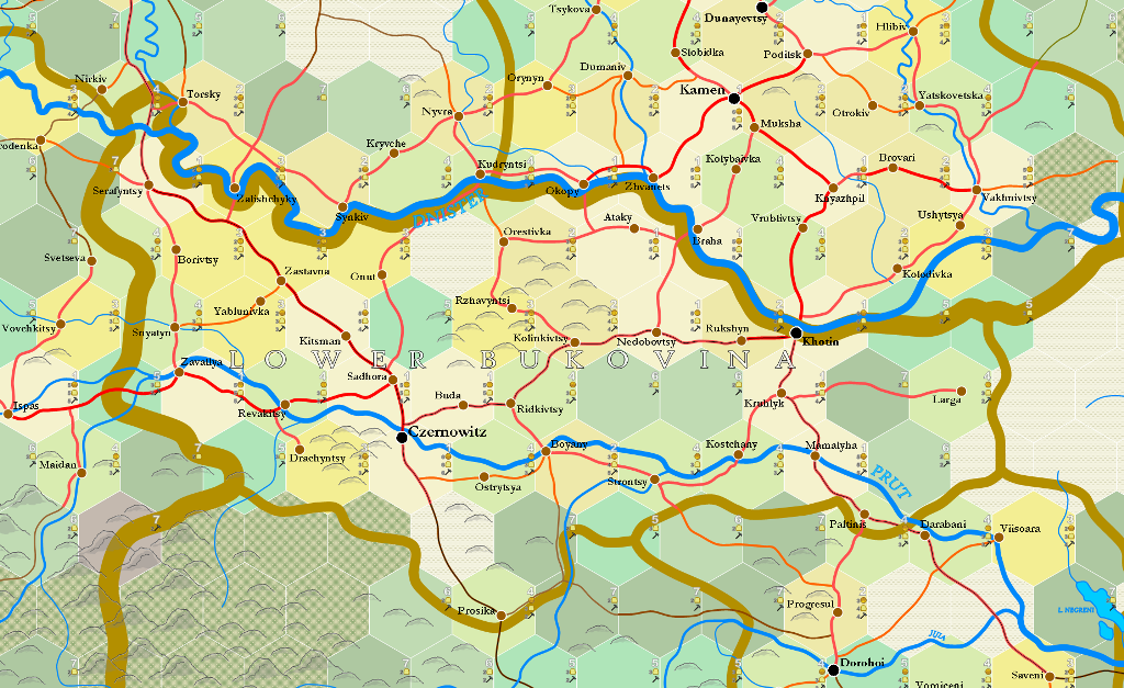
6-mile Hex Map
6-mile hex maps are zoomed-in maps derived from 20-mile hex maps, using a complex procedure of map drawing and random generation deriving from a map's infrastructure and real-world topography and place names.
Contents
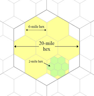
The designation "6-mile" is an inaccurate description. 6-mile hexes are derived from splitting a 20-mile hex, as shown in the image below, and are in fact 6.67 mi. in diameter, not six. Nonetheless, the "6-mile" appellation is used as a simplification.
Generation Procedure
Once the infrastructure of a given 20-mile hex has been determined, and all of its surrounding hexes as well, a 6-mile hex template is laid over the 20-mile hex map. Every 20-mile hex has a precise designation as to its latitude and longitude coordinates, so that a rectangular "section" of the area to be mapped can be located on GoogleEarth.

