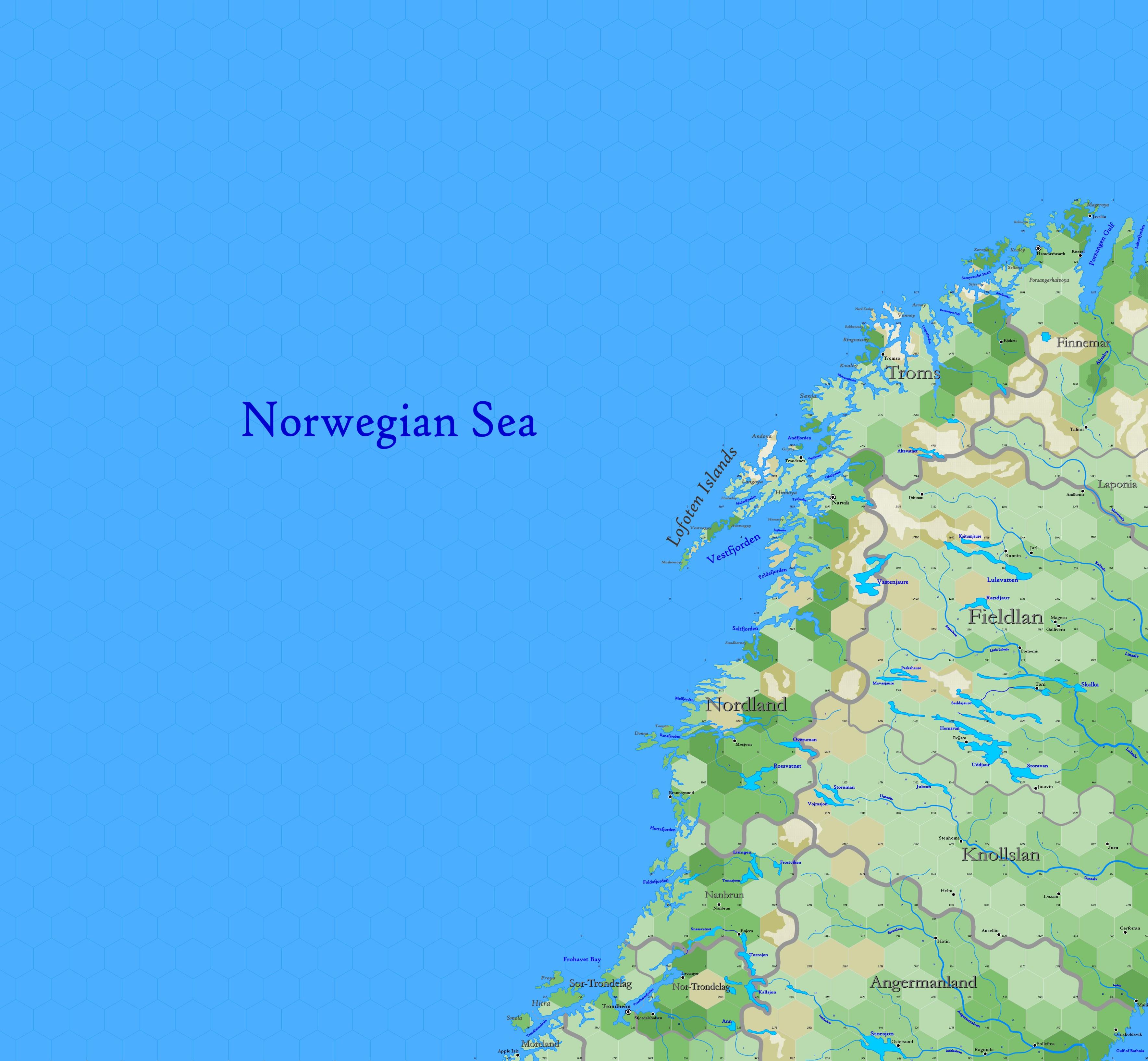
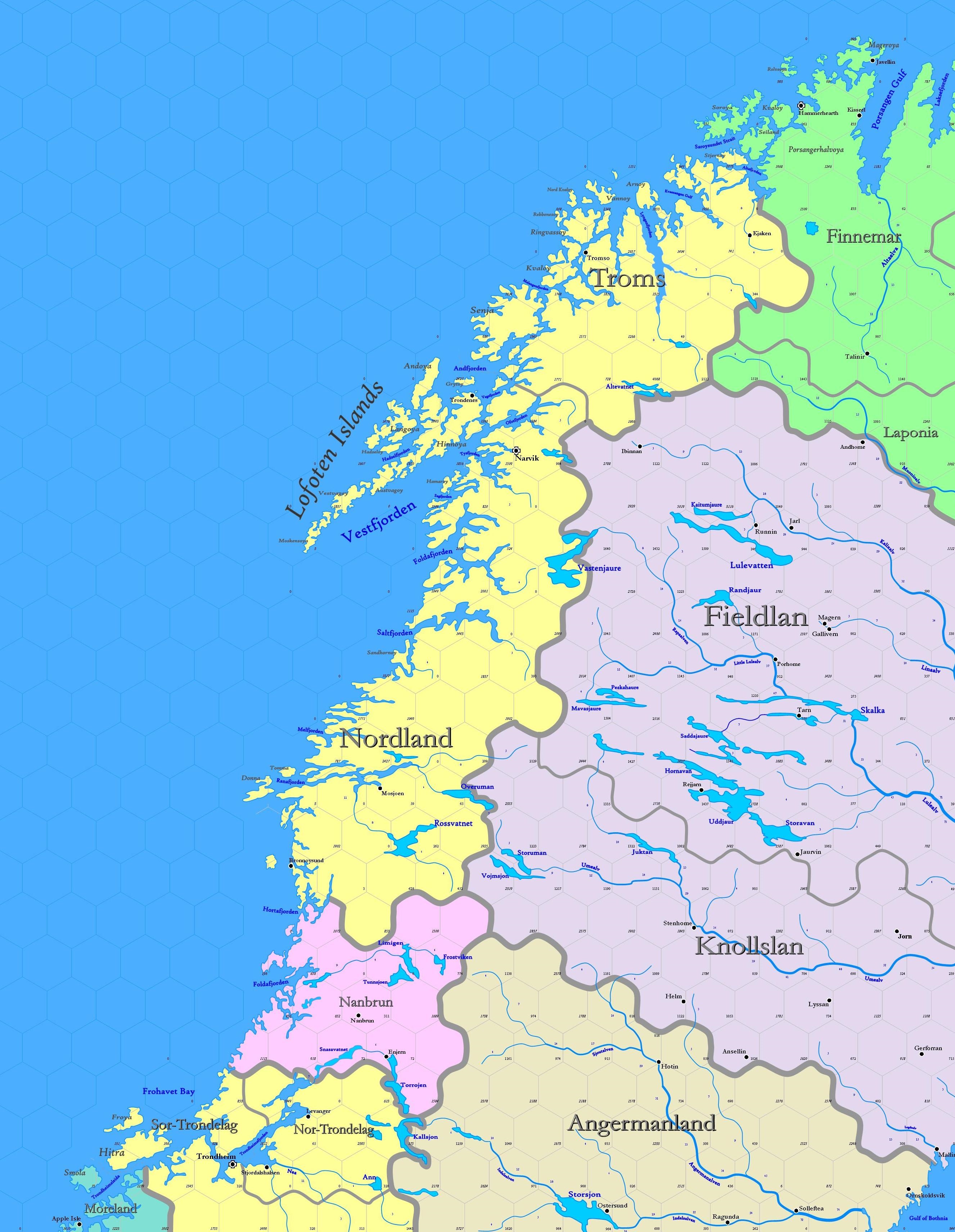
Map B.01 - Lofoten
Sub-arctic region reaching from 77.22°N south to 62.96°N, including the upper peninsula of Scandinavia, a region shared by many races. The upper peninsula is formed of an elevated plateau which rises steeply from the Atlantic. The irregular outline of the has been caused by the same agent, a glacier or river of ice. The sides of the fjords are steep and often rise to heights of 4,000 ft. At the head of each fjord is a meadowland surrouding a stream descending from the mountains. Arranged along the coast is the skerry-guard, hundreds of small, rocky islands that act as a protection from the Atlantic storms. There is a near continuous quiet water route through the lee of these islands. These islands allowed the Norse to learn their sailing trade.
Hexes are 20 miles in diameter. Total area depicted equals 403,095 sq.m.
Contents
Features
Norwegian Sea
A marginal sea in the Atlantic, between the North Sea and the Greenland Sea, the latter boundary marked by the island of Jan Mayen. The Norwegian Sea has a great depth and for that reason has never been associated with a subterranean culture. The coastal zones are rich in fish, with Norway has long exploited. The North Atlantic Current ensures stable temperatures the year round, so that unlike the Greenland Sea, the Norwegian is ice-free.
The Scandes form a backbone that forms a rigid boundary between the western Norse provinces and the Baltic provinces of the east. The mountains are not very high but are very steep in places; their shape has enabled the formation of many ice fields and glaciers. The northern range is collectively known as the Kjølen, where the mountains are narrower north of Trondelag. Most of these mountains lack alpine ranges, as their steep sides and rocky peaks give little purchase for flora or fauna of that type. In the upper valleys, however, tundra ranges predominate.
Norwegian Provinces
The most populated and significant entity on the map, the Norwegian Provinces shown a part of the human Kingdom of Denmark & Norway. The western borders are fixed by the Kjølen Mountains, whereas those with friendly Nanbrun and Moreland were settled after some political strife centuries ago. Those entities to the east of the mountains are viewed with antipathy. There are four provinces, with a combined area of ... and a population of ...
Nordland
The County of Nordland is a mountainous region in the northwest, indented with many fjords, valleys and narrow lowland areas along the sea. The county includes the Lofoten Islands. Fishing is the more important activity and the sole economy of many small hamlets. The southern part is called Helgaland, where Bronnoysund and Mosjoen are found. The island
Nor-Trondelag
Sor-Trondelag (partial)
Troms
The County of Troms is the northernmost land of the Kingdom of Denmark & Norway, settled by the Norse in the late 10th century. Troms has a very rugged and indented coastline facing the Norwegian Sea, though the large and mountainous islands along the coast shelter the important sea-route between Europe and the Barents Sea. Several large fjords stretch quite far inland. Vegetation is arctic, with only dwarfed birches and low grasses & shrubs. The county is remote and lacks any market; goods are transshipped through the largest settlement and town, Tromso, 140 miles south to Narvik. The county is 21.3 hexes in size, with a population of 13,093.

