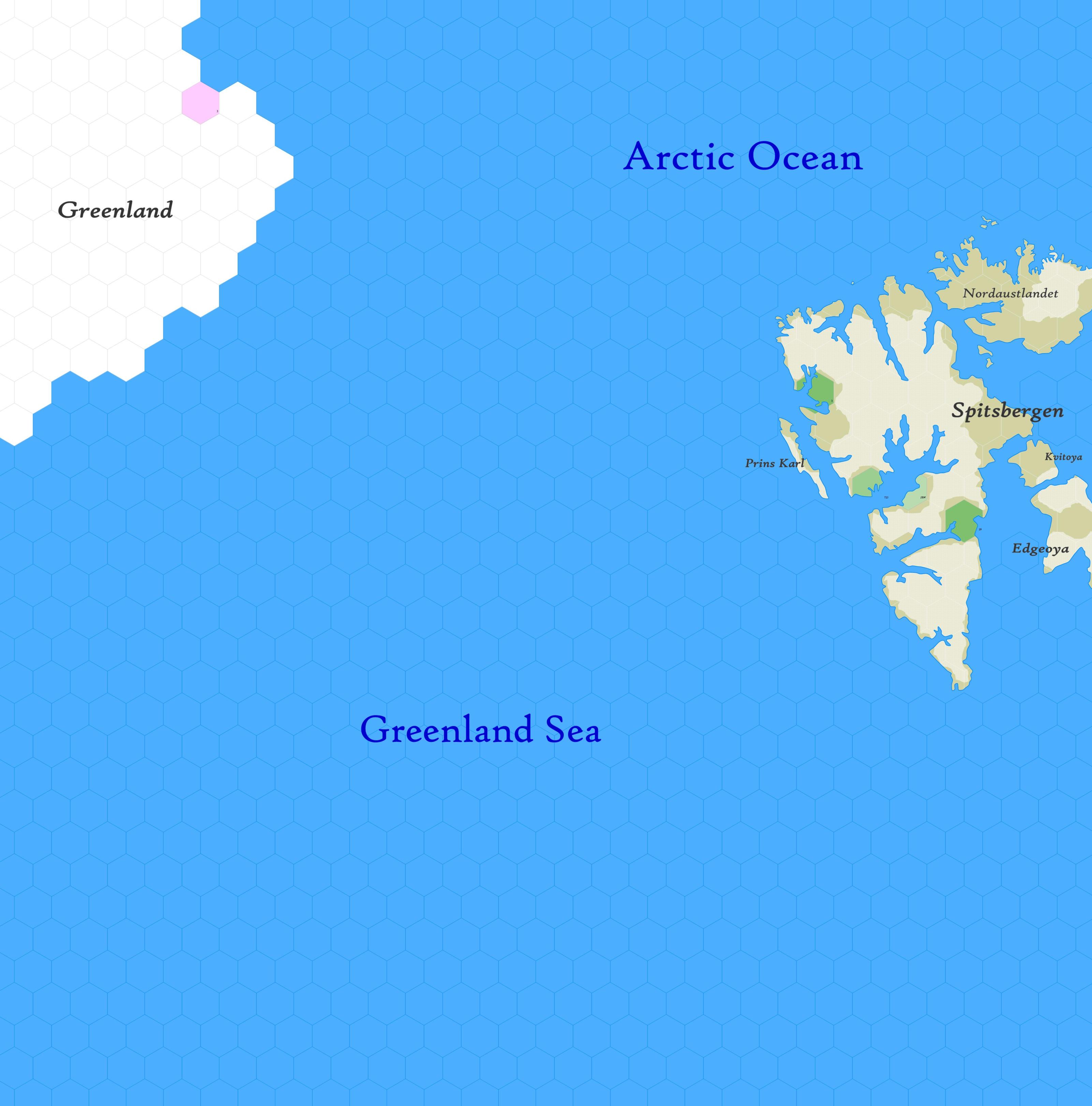
Map A.01 - Greenland Sea
The Greenland Sea map, incomplete, shows the unfinished east coast of Greenland on the left and Spitsbergen on the right, in the extreme arctic part of the contemporary political entity of Canada, between 72.51°N to 82.34°N. The map's hexes are 20 miles in diameter. The total area is about 366,000 square miles.
Contents
This remote and inhospitable region is largely unexplored by European explorers. The harsh Arctic climate, with its icy waters and severe weather conditions, makes navigation and exploration challenging. The Greenland Sea is frozen for a significant portion of the year, limiting access and navigation. Sea ice makes maritime activities difficult and risky, discouraging extensive exploration of the area.
Nonetheless, the region is important for commercial activities such as whaling and the hunting of seals and walruses. European nations, particularly the Dutch and English, seek these valuable resources — though there are tales of ships being wrecked by gigantic behemoths, or of the destruction of temporary settlements on Spitsbergen by frost-covered trolls.
Features
Greenland Sea. A body of water linking the Arctic Ocean with the Atlantic Sea, bordered by Greenland to the west, the Bering Sea to the east, and the Norwegian Sea to the south. The sea is known for its extensive ice cover, particularly during the colder seasons, where ice floes and bergs are prominent features, creating a challenging environment for navigators. Variations in sea ice extent occur depending on climatic conditions, influencing maritime activities and trade routes in the region.
- The Greenland sea is home to various marine species, including seals, whales, walruses, narwhal and sea serpents. The climate is harsh, with cold temperatures and unpredictable weather patterns. The underwater topography is largely undiscovered and poorly understood.
Spitsbergen.
Spitsbergen
An unexplored archipelago in the extreme north of the world, comprising five major islands and many smaller ones. It measures approximately 250 mi. from east to west; its northern edge has never been observed. The topography is highly broken with the pointed mountain peaks — spits bergen — reaching to above 5,000 ft. Much of the surface of the larger islands is covered with tremendous glaciers which reach down to the ocean, where their ice calves into icebergs. The coasts are indented by deep fjords. Rivers rush in the summer, when the snow lying at elevations up to 1,600 ft. melts; however, these are small and of little importance. The greater part of the limited precipitation reaches the sea in the form of glacier ice. The vegetation is of the tundra range, principally mosses, with some flowering plants and a few dwarf trees. The climate is arctic, with brisk summer temperatures.
Discovered by the Norse in 1194 A.D. and rediscovered in 1596 by the Dutch navigator Willem Barens, the islands are visited yearly by whalers and sealers. Ordinary fauna include walruses, polar bears, reindeer and foxes. Various birds, including the eider duck, ptarmigan, gulls and the snowy owl frequent Spitsbergen. Details about Spitsbergen's residents are unknown.
Adjacent Maps
| A12: High Greenland | A1: Greenland Sea | A2: East Spitsbergen | |
|---|---|---|---|
| B18: Iceland | B1: Lofoten | ||
See Sheet Maps
