Difference between revisions of "Map A.09 - Melville"
Tao alexis (talk | contribs) |
Tao alexis (talk | contribs) |
||
| Line 12: | Line 12: | ||
<br> | <br> | ||
And from Wikipedia,<br> | And from Wikipedia,<br> | ||
| − | :[https://en.wikipedia.org/wiki/M%27Clure_Strait McClure Strait] | + | :[https://en.wikipedia.org/wiki/M%27Clure_Strait McClure Strait] / [https://en.wikipedia.org/wiki/Prince_Gustav_Adolf_Sea Prince Gustof Adolf Sea] / Qikiqtaaluk Region |
Revision as of 23:35, 8 March 2020
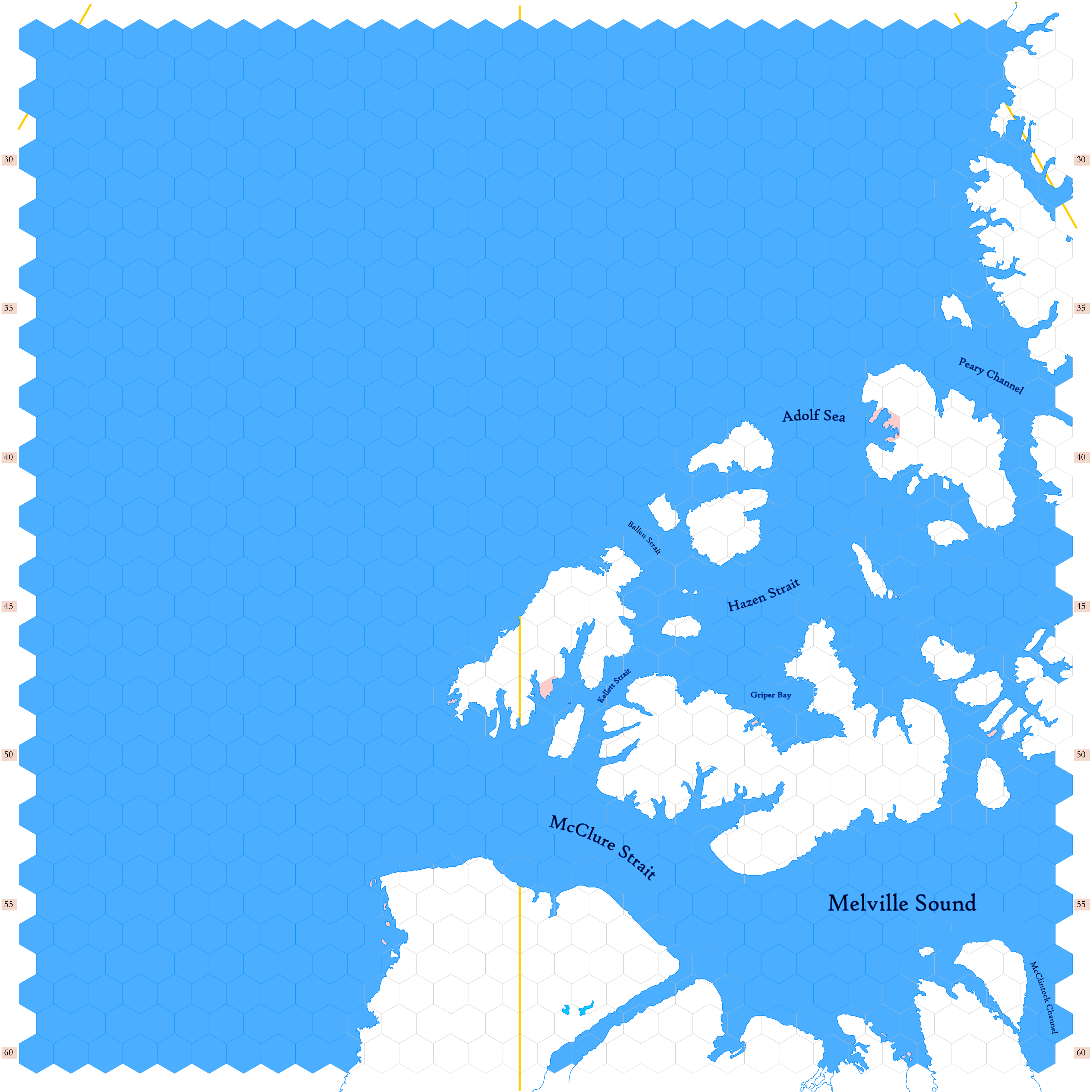
Click to enlarge. Shows latitude 72.51 to 82.34 north, including islands from the Canadian Arctic Archipelago, including Melville, Banks, Victoria and Ellef Ringnes islands, with parts of Axel Heiberg, Bathurst and Ellesmere islands. There are exactly two civilized hexes in all this vast area — I've made no plans for what may dwell here at this time. The area is so remote that it seems unimportant; I don't imagine I'll ever see players running in this part of the world.
Orange lines indicate 150°W (top left), 120°W (center) and 90°W (top right). Thus, the top left of the map is north of Anchorage, the center is north of Calgary, while the top right is north of St. Louis. Hexes are 20 miles in diameter. Numbers on the left and right indicate distance from the North Pole in hexes.
See Also,
Sheet Maps
And from Wikipedia,
- McClure Strait / Prince Gustof Adolf Sea / Qikiqtaaluk Region
