Difference between revisions of "Map A.01 - Greenland Sea"
From The Authentic D&D Wiki
Jump to navigationJump to searchTao alexis (talk | contribs) |
Tao alexis (talk | contribs) |
||
| Line 8: | Line 8: | ||
See Also,<br> | See Also,<br> | ||
[[Sheet Maps]]<br> | [[Sheet Maps]]<br> | ||
| − | East: [[Map A.02 - East Svalbard|East Svalbard]] | + | :East: [[Map A.02 - East Svalbard|East Svalbard]] |
Revision as of 20:53, 8 March 2020
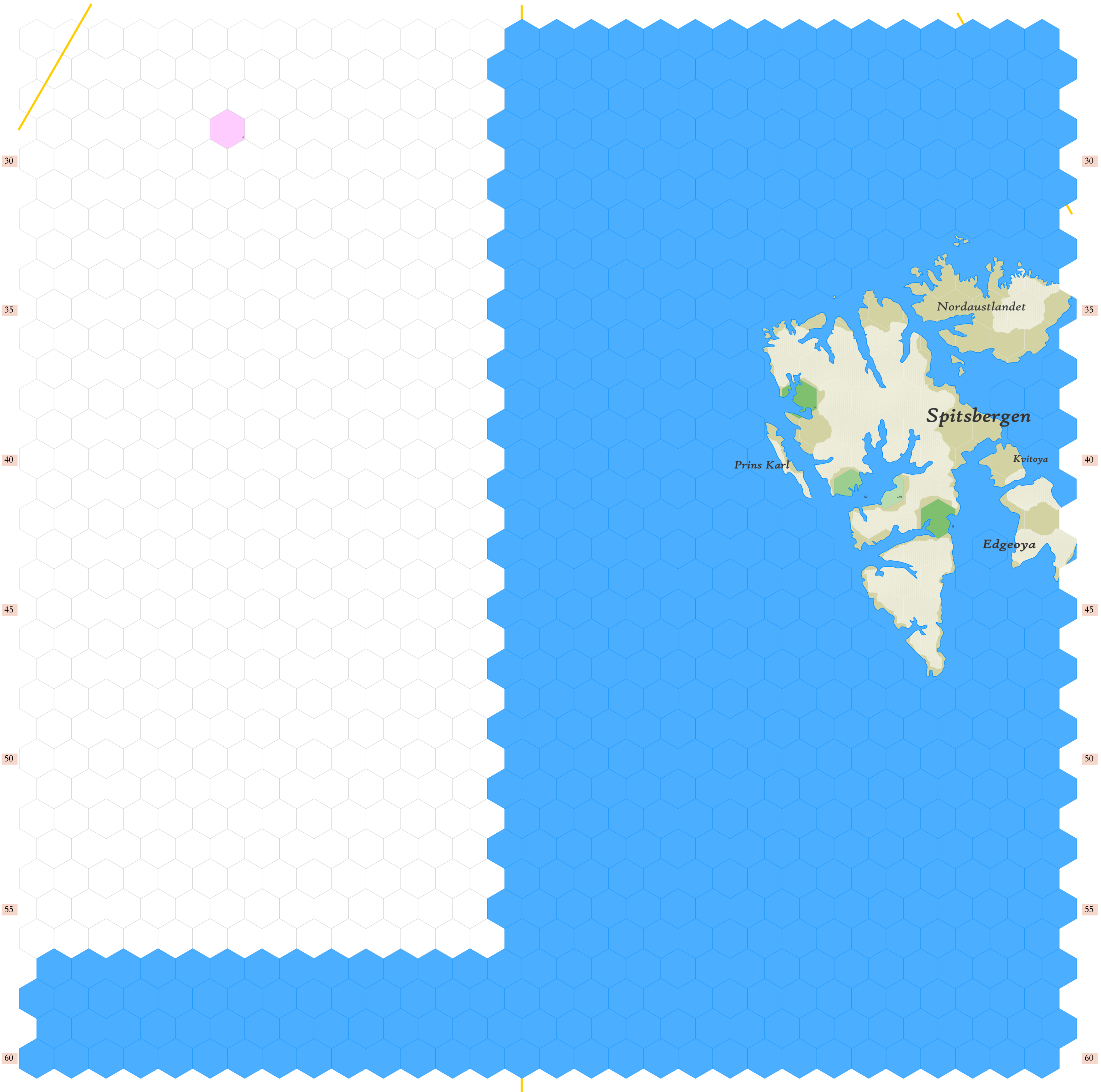
Click to enlarge. Shows latitude 72.51 to 82.34 north, including Spitsbergen and associated islands of Svalbard. Whited out, incompleted map is of the extreme northeast coast of Greenland, as yet unplotted. Details of the residents on this map are being withheld for the day when my players find a reason to go here. The hydrosphere in this part of the world is known as the Greenland Sea, bordering upon the Fram Strait into the Arctic Ocean.
Orange lines indicate 30°W (top left), 0° (center) and 30°E (top right). Hexes are 20 miles in diameter. Numbers on the left and right indicate distance from the North Pole in hexes.
See Also,
Sheet Maps
- East: East Svalbard
