Difference between revisions of "Hadramaut, Sheikdom of"
Tao alexis (talk | contribs) |
Tao alexis (talk | contribs) |
||
| Line 1: | Line 1: | ||
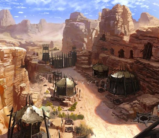
[[File:Hadramaut.jpg|right|525px|thumb|]] | [[File:Hadramaut.jpg|right|525px|thumb|]] | ||
| − | The '''Sheikdom of Hadramaut''' comprises a host of independent sultanates and tribal states within the Imamate of [[Zaida, Imamate of|Zaida]]. These act in concert, with no single ruler, yet they've often shown themselves to vigorous in the defense of their lands. The greater part of Hadramaut is made up of desert and barren mountains intersected by wadis, some of which are fertile. Small-scale encampments for caravans act as independent fortified water holes; trade is carried out overland with [[Sheba, Sheikdom of|Sheba]] to the west and Oman to the east, or through the ports on the [[Berbera, gulf of| | + | The '''Sheikdom of Hadramaut''' comprises a host of independent sultanates and tribal states within the Imamate of [[Zaida, Imamate of|Zaida]]. These act in concert, with no single ruler, yet they've often shown themselves to vigorous in the defense of their lands. The greater part of Hadramaut is made up of desert and barren mountains intersected by wadis, some of which are fertile. Small-scale encampments for caravans act as independent fortified water holes; trade is carried out overland with [[Sheba, Sheikdom of|Sheba]] to the west and Oman to the east, or through the ports on the gulf of [[Berbera, gulf of|Berbera]]. Population (c.1650), 45,911. |
__TOC__ | __TOC__ | ||
A narrow coastal plain along the gulf is bounded by the steep escarpment of a broad plateau, with a very sparse network of deeply sunk wadis, many of which drain into basins of the interior rather than into the sea. On the north edge of this plateau is the Rub al'Khali ("Empty Quarter") an enormous deserted area which is impassable where it meets Hadramaut. The climate is hot and dry, ranging from [[Pleasant Conditions|pleasant]] in the winter to [[Sweltering Conditions|sweltering]] in the summer along the coast; inland, upon the high plateau, the conditions are somewhat [[Cool Conditions|cool]] in winter. | A narrow coastal plain along the gulf is bounded by the steep escarpment of a broad plateau, with a very sparse network of deeply sunk wadis, many of which drain into basins of the interior rather than into the sea. On the north edge of this plateau is the Rub al'Khali ("Empty Quarter") an enormous deserted area which is impassable where it meets Hadramaut. The climate is hot and dry, ranging from [[Pleasant Conditions|pleasant]] in the winter to [[Sweltering Conditions|sweltering]] in the summer along the coast; inland, upon the high plateau, the conditions are somewhat [[Cool Conditions|cool]] in winter. | ||
Revision as of 21:55, 13 May 2023
The Sheikdom of Hadramaut comprises a host of independent sultanates and tribal states within the Imamate of Zaida. These act in concert, with no single ruler, yet they've often shown themselves to vigorous in the defense of their lands. The greater part of Hadramaut is made up of desert and barren mountains intersected by wadis, some of which are fertile. Small-scale encampments for caravans act as independent fortified water holes; trade is carried out overland with Sheba to the west and Oman to the east, or through the ports on the gulf of Berbera. Population (c.1650), 45,911.
A narrow coastal plain along the gulf is bounded by the steep escarpment of a broad plateau, with a very sparse network of deeply sunk wadis, many of which drain into basins of the interior rather than into the sea. On the north edge of this plateau is the Rub al'Khali ("Empty Quarter") an enormous deserted area which is impassable where it meets Hadramaut. The climate is hot and dry, ranging from pleasant in the winter to sweltering in the summer along the coast; inland, upon the high plateau, the conditions are somewhat cool in winter.
History
Hadramaut's political history begins around the 7th century BC, when it competed with the kingdom of Qataban in trade and for its independence. At the start of the 1st century AD, "Hadramawt" would overcome Qataban and establish a kingdom stretching west to Yamen. This would last until 290, when it would become part of the Sabaean kingdom. Thereafter, as the western regions of Sheba and Yamen would change hands, Hadramaut rose and fell as various conquerors endeavoured to conquer the people there. At the same time, the desolate land served as a refuge for rebellious forces who, over a millennia, would eventually birth the Zaida Imamate that wrested control of the region from outsiders.
Trade
Though backward technologically, with few amenities, Hadramaut is unexpectedly wealthy in raw materials and numerous handicraft manufactures. Marketing of these goods take place in three cities spaced along the coast facing the Gulf of Berbera and the Arabian Sea. From west to east, these are Mukalla, Ash Shahar and Sayhut. All three are small towns of just over a thousand residents each.
Mukalla it's the richest market2R of the three, having the best position on the east-west trade route that passes in and out of Crater, some 275 mi. to the west. Goods gathered and transshipped out of Mukalla include meat, skins, indigo2R, tobacco and dates.
Ash Shahar, 38 mi. further east, is a small market, though with good access to the interior. Goods gathered and transshipped include silver, salt, cloth, camelhair, leathercrafted goods, gum Arabic, resin, cereals, maize, oats, figs, camels and slaves.
Sayhut, 100 mi. further east, has the best access to markets in the Persian Gulf. Goods gathered and transshipped include lead, salt, leathercrafted goods, timber (mostly palms), shipbuilding (dhows), frankincense2R, sesame seed, dates, grapes and fish fins. Sayhut acts as a market for the island of Socotra to the south.
