Difference between revisions of "Map A.12 - High Greenland"
From The Authentic D&D Wiki
Jump to navigationJump to searchTao alexis (talk | contribs) |
Tao alexis (talk | contribs) |
||
| Line 1: | Line 1: | ||
[[File:A.12 - High Greenland.png|680px|thumb]] | [[File:A.12 - High Greenland.png|680px|thumb]] | ||
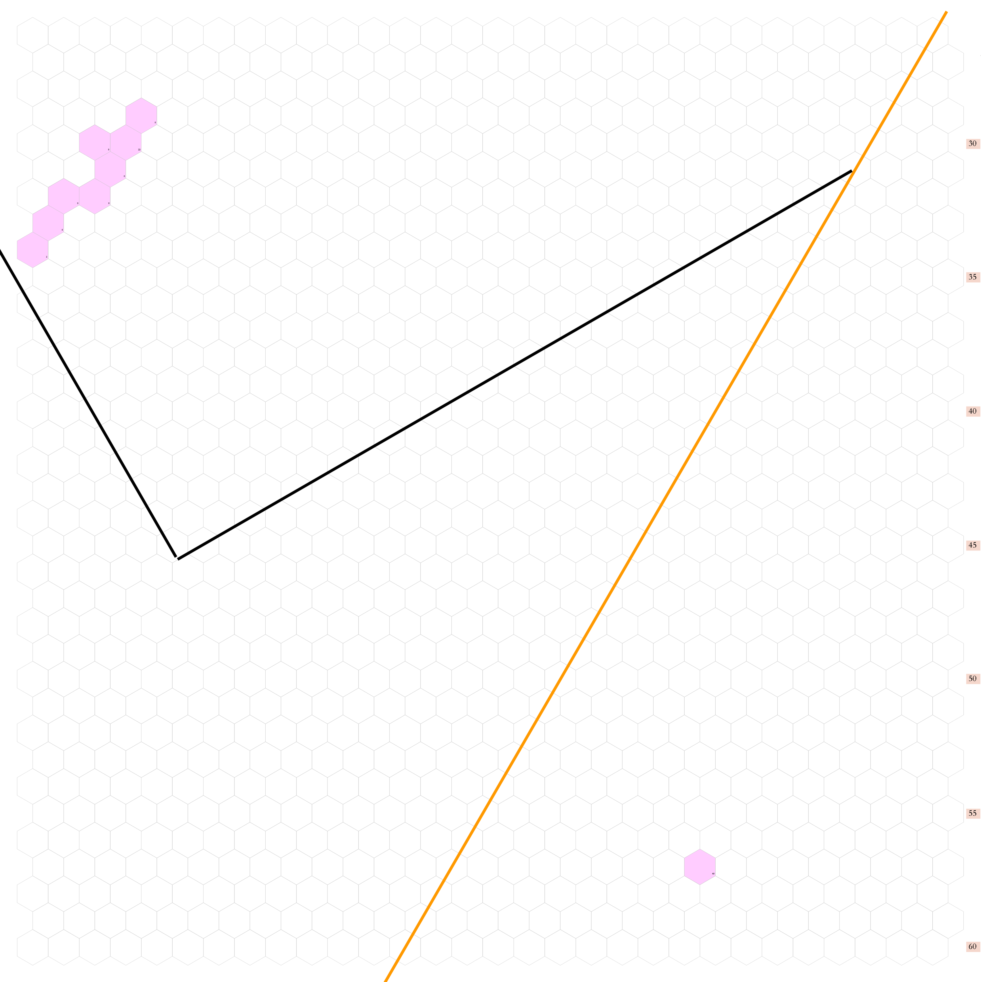
| + | Shows latitude 72.51 to 82.34 north, with the map incompleted. The map will include a portion of Greenland's harsh, uninhabited eastern shore, once the coastline is plotted. | ||
| − | + | The orange line, showing at the center bottom and top right, gives the line of hexes that indicates 30°W. Numbers at the right indicate distance from the north pole in hexes; the direction of north is at the top right, so it must be noted the direction on the map turns 60° at the 30th meridian. Hexes are [[20-mile Hex Map|20 miles]] in diameter. | |
| − | + | == Political Entities == | |
| − | + | None known at this time. | |
| − | + | ||
| − | + | == Adjoining Maps == | |
| − | + | '''Listed Clockwise''' | |
:East: [[Map A.01 - Greenland Sea|Greenland Sea]]<br> | :East: [[Map A.01 - Greenland Sea|Greenland Sea]]<br> | ||
| + | :Southeast: [[Map B.01 - Lofoten|Lofoten]]<br> | ||
| + | :Southwest: [[Map B.18 - Iceland|Iceland]]<br> | ||
:West: [[Map A.11 - West Greenland|West Greenland]]<br> | :West: [[Map A.11 - West Greenland|West Greenland]]<br> | ||
| − | + | ||
| − | [[ | + | |
| + | See [[Sheet Maps]]<br> | ||
Revision as of 17:37, 30 September 2020
Shows latitude 72.51 to 82.34 north, with the map incompleted. The map will include a portion of Greenland's harsh, uninhabited eastern shore, once the coastline is plotted.
The orange line, showing at the center bottom and top right, gives the line of hexes that indicates 30°W. Numbers at the right indicate distance from the north pole in hexes; the direction of north is at the top right, so it must be noted the direction on the map turns 60° at the 30th meridian. Hexes are 20 miles in diameter.
Political Entities
None known at this time.
Adjoining Maps
Listed Clockwise
- East: Greenland Sea
- Southeast: Lofoten
- Southwest: Iceland
- West: West Greenland
See Sheet Maps
