Difference between revisions of "Map A.10 - Bathurst"
Tao alexis (talk | contribs) |
Tao alexis (talk | contribs) |
||
| (10 intermediate revisions by the same user not shown) | |||
| Line 1: | Line 1: | ||
| − | [[File:A.10 - Bathurst. | + | [[File:A.10 - Bathurst.jpg|630px|thumb]] |
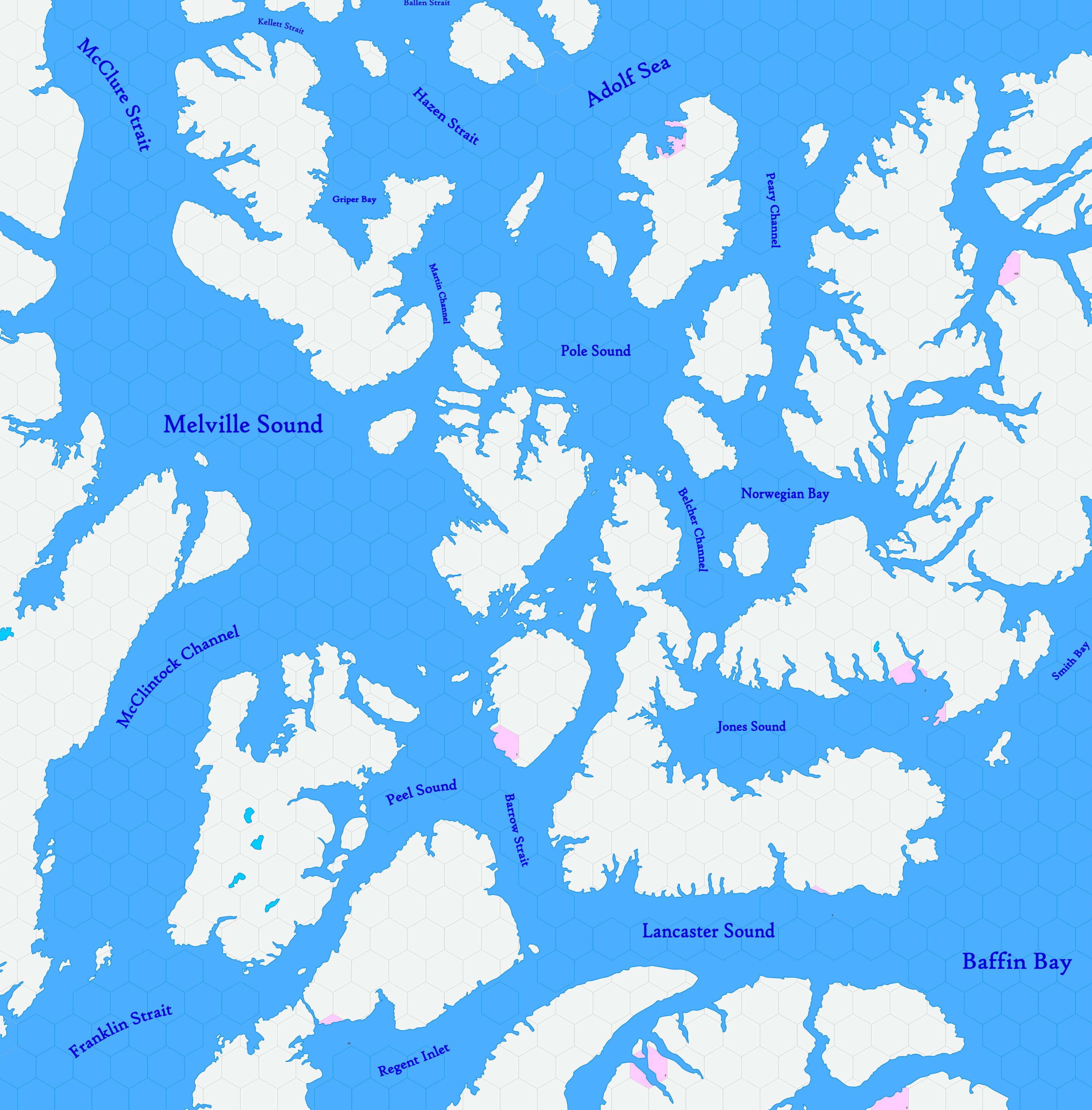
| + | The '''Bathurst''' map, incomplete, shows lands of the Inuktitut in the extreme arctic part of the contemporary political entity of [[:Category:Places in Canada|Canada]], between 72.51°N to 82.34°N. The map's hexes are [[20-mile Hex Map|20 miles]] in diameter. The total area is about 366,000 square miles. | ||
| + | __TOC__ | ||
| + | The realm shown is shrouded in eternal ice and darkness for much of the year. A desolate and frigid expanse, far to the north of known civilization, the landscape consists of towering glaciers and frozen fjords, where the chill of winter never truly relinquishes its grip. The archipelago is a labyrinth of icy passages and treacherous straits, where few tribal peoples dwell. The nearest that Europeans have approached to this land in the mid-17th century has been Martin Frobisher, who may have ventured briefly into the southeast of this map between 1576 and 1578. | ||
| − | + | In the winter months, the archipelago is plunged into a never-ending night, with the shimmering auroras painting the sky in shades of green and violet. The icy waters are home to seals and whales, creatures vital for the survival of the hardy Inuit peoples who call this unforgiving land their home. These indigenous inhabitants have mastered the art of survival in this harsh realm, relying on their knowledge of the land and sea to eke out a meager existence. | |
| − | + | == Adjacent Maps == | |
| + | {| class="wikitable" style="text-align: center; background-color:#d4f2f2;" | ||
| + | |- | ||
| + | ! style="width: 120px|[[Map A.09 - Melville|A9: Melville]] !! style="width: 120px|[[Map A.10 - Bathurst|A10: Bathurst]] !! style="width: 120px|[[Map A.11 - West Greenland|A11: West Greenland]] | ||
| + | |- | ||
| + | ! [[Map B.13 - Barrens|B13: Barrens]] !! [[Map B.14 - Hudson Passage|B14: Hudson Passage]] !! [[Map B.15 - Baffin|B15: Baffin]] | ||
| + | |} | ||
| − | + | ||
| − | + | See [[Sheet Maps]] | |
| − | + | ||
| − | See | + | [[Category: Reviewed]] |
| − | [[Sheet Maps]] | ||
| − | |||
| − | |||
| − | |||
Latest revision as of 17:51, 2 November 2023
The Bathurst map, incomplete, shows lands of the Inuktitut in the extreme arctic part of the contemporary political entity of Canada, between 72.51°N to 82.34°N. The map's hexes are 20 miles in diameter. The total area is about 366,000 square miles.
Contents
The realm shown is shrouded in eternal ice and darkness for much of the year. A desolate and frigid expanse, far to the north of known civilization, the landscape consists of towering glaciers and frozen fjords, where the chill of winter never truly relinquishes its grip. The archipelago is a labyrinth of icy passages and treacherous straits, where few tribal peoples dwell. The nearest that Europeans have approached to this land in the mid-17th century has been Martin Frobisher, who may have ventured briefly into the southeast of this map between 1576 and 1578.
In the winter months, the archipelago is plunged into a never-ending night, with the shimmering auroras painting the sky in shades of green and violet. The icy waters are home to seals and whales, creatures vital for the survival of the hardy Inuit peoples who call this unforgiving land their home. These indigenous inhabitants have mastered the art of survival in this harsh realm, relying on their knowledge of the land and sea to eke out a meager existence.
Adjacent Maps
| A9: Melville | A10: Bathurst | A11: West Greenland |
|---|---|---|
| B13: Barrens | B14: Hudson Passage | B15: Baffin |
See Sheet Maps
