Difference between revisions of "Map B.04 - Ob Gulf"
From The Authentic D&D Wiki
Jump to navigationJump to searchTao alexis (talk | contribs) |
Tao alexis (talk | contribs) |
||
| Line 1: | Line 1: | ||
[[File:B.04 - Ob Gulf.jpg|right|680px|thumb]] | [[File:B.04 - Ob Gulf.jpg|right|680px|thumb]] | ||
| + | |||
| + | [[File:B.03 - Yak'Margug.jpg|right|680px|thumb]] | ||
| + | |||
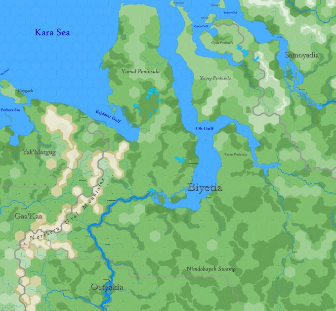
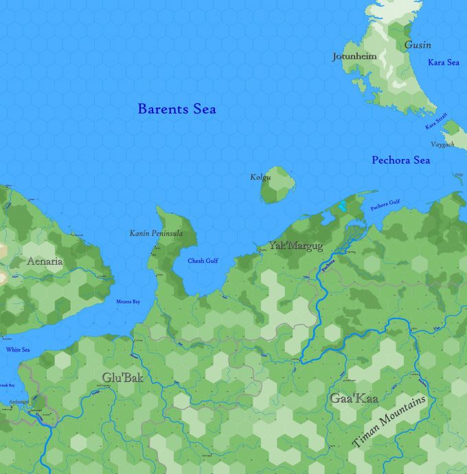
| + | Sub-arctic region reaching from 77.22°N south to 62.96°N, principally showing the northern provinces of [[Kingdom of Magloshkagok|Magloshkagok]], [[Haftsmark of Biyetia|Biyetia]] and [[Haftsmark of Ostyakia|Ostyakia]], as well as the lower Ob River and the immense Ob Gulf estuary. This is followed on each side by the Yamal and Yavey peninsulas. The land east and southeast of the Northern Ural Mountains is commonly called "Siberia" by Europeans — this land extends for many thousands of miles beyond what is shown on the map. The Ob River in its lower part serves as a minor trade route. Occasionally European Whalers venture into the Kara Sea in warm summers. | ||
| + | |||
| + | Hexes are [[20-mile Hex Map|20 miles]] in diameter. Total area depicted equals 403,095 sq.m. | ||
Latest revision as of 02:26, 22 July 2021
Sub-arctic region reaching from 77.22°N south to 62.96°N, principally showing the northern provinces of Magloshkagok, Biyetia and Ostyakia, as well as the lower Ob River and the immense Ob Gulf estuary. This is followed on each side by the Yamal and Yavey peninsulas. The land east and southeast of the Northern Ural Mountains is commonly called "Siberia" by Europeans — this land extends for many thousands of miles beyond what is shown on the map. The Ob River in its lower part serves as a minor trade route. Occasionally European Whalers venture into the Kara Sea in warm summers.
Hexes are 20 miles in diameter. Total area depicted equals 403,095 sq.m.

