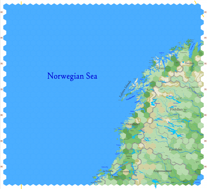
Map B.01 - Lofoten
Click to enlarge. Shows latitude 62.96° to 72.50° north; shows longitude at bottom of map between 1.94°W and 19.34°E. The orange line on the left of the map indicates 0° Greenwich; the orange line at the upper right indicates 30°E. Hexes are 20 miles in diameter. Numbers on the left and right indicate distance from the North Pole in hexes.
Land
The map depicts the whole of Nanbrun, with parts of Breen (Moreland), Denmark & Norway (Nordland, Nor-Trondelag, Sor-Trondelag, Troms), Sweden (Angermanland), Ulthua (Finnemar, Laponia) and Vastenjaur (Fieldlan, Knollslan). The map is named after the Lofoten Islands located on the coast of Nordland. Other significant islands include (from north to south) Mageroya, Soroya, Ringvassoy, Senja and Hitra. The most important rivers include the Angermanalven, Umealv, Lulealv and Kalixalv. The largest lakes include the Storsjon and Hornavan. The map also shows parts of the Gulf of Bothnia and the Norwegian Sea.
