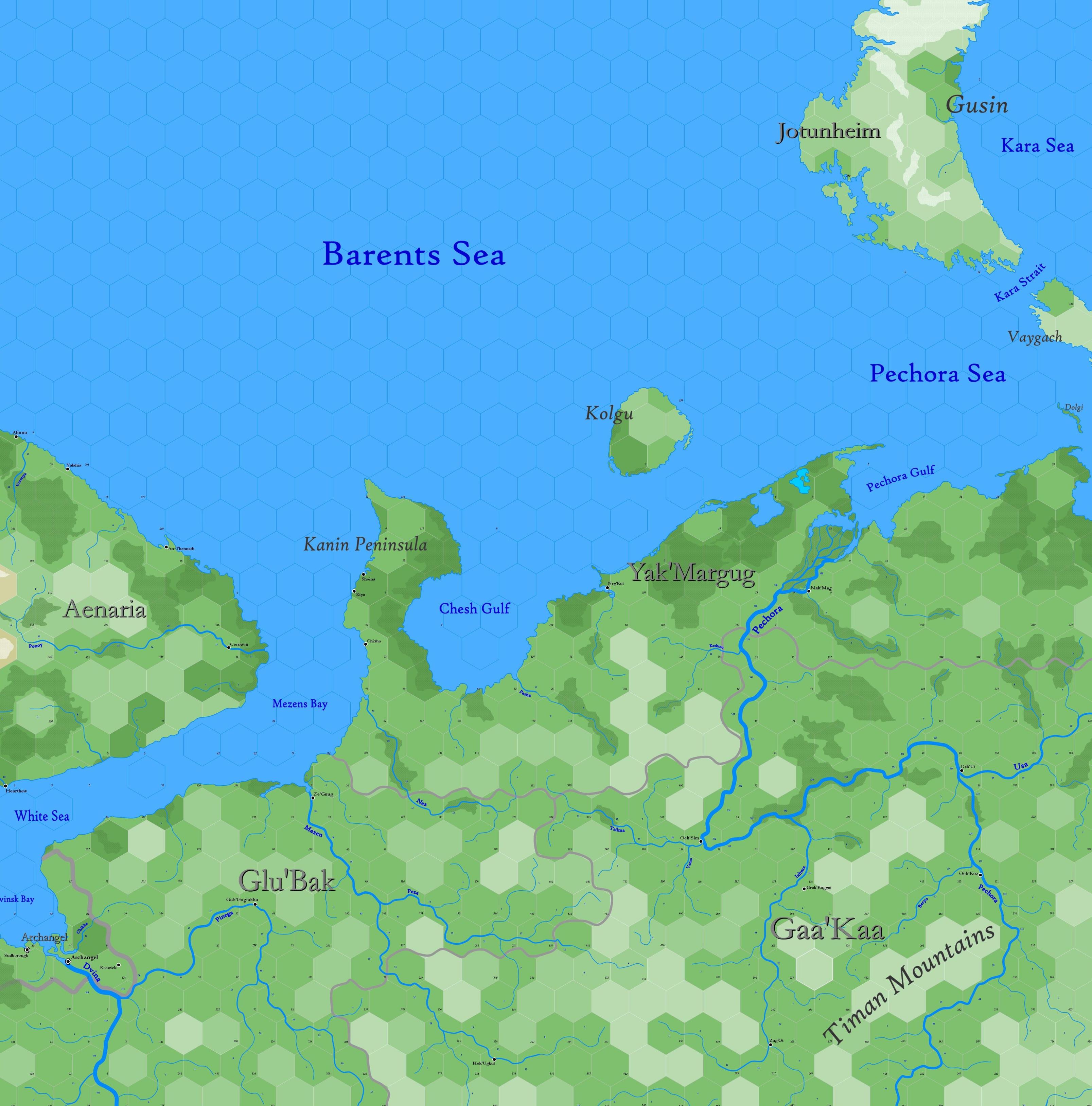
Map B.03 - Yak'Margug
Sub-arctic region reaching from 77.22°N south to 62.96°N, comprising the south shore of the Barents Sea and the sweeping taiga forest of gnollish Bjarmaland, including parts of Ulthua on the west and Jotunheim at the top right. An important sea-trade route from Archangel on the White Sea connects this isolated land with the rest of Europe. The Barents and Pechora sea are visited yearly by whaling vessels who call the waters here the Devils' Dance Floor, on account of the many icebergs found in the summer. Access to the Kara Sea is managed through the Kara Strait.
Hexes are 20 miles in diameter. Total area depicted equals 366,450 sq.m.
Features
Barents Sea
A portion of the Arctic Ocean, stretching northward from Finnemar and Aenaria. The sea is named after Willem Barents, who mapped the sea in the 16th century while searching for the Northeast Passage to China; it is called Edhellen by elves. The depth of this part is no more than 80 fathoms. Eddies and currents are numerous and complex, which contributes to the warm waters brought from the North Atlantic drift, so that the portion within 20-30 miles of land never freezes. Bergs are common beyond this passage. Although water temperatures vary from year to year, they are coolest in April and warmest in October. Except during this period, the remainder of the sea shown is frozen. Haddock, cod and plaice are plentiful and caught in large numbers.
