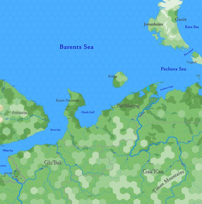
Map B.03 - Yak'Margug
From The Authentic D&D Wiki
Revision as of 22:31, 17 July 2021 by Tao alexis (talk | contribs)
Sub-arctic region reaching from 77.22°N south to 62.96°N, comprising the south shore of the Barents Sea and the sweeping taiga forest of gnollish Bjarmaland, including parts of Ulthua on the west and Jotunheim at the top right. An important sea-trade route from Archangel on the White Sea connects this isolated land with the rest of Europe. The Barents and Pechora sea are visited yearly by whaling vessels who call the waters here the Devils' Dance Floor, on account of the many icebergs found in the summer. Access to the Kara Sea is managed through the Kara Strait.
Hexes are 20 miles in diameter. Total area depicted equals 366,450 sq.m.
