Difference between revisions of "Map B.02 - Lapland"
From The Authentic D&D Wiki
Jump to navigationJump to searchTao alexis (talk | contribs) (Created page with "Placeholder.") |
Tao alexis (talk | contribs) |
||
| Line 1: | Line 1: | ||
| − | + | [[File:B.02 - Lapland.png|680px|thumb]] | |
| + | |||
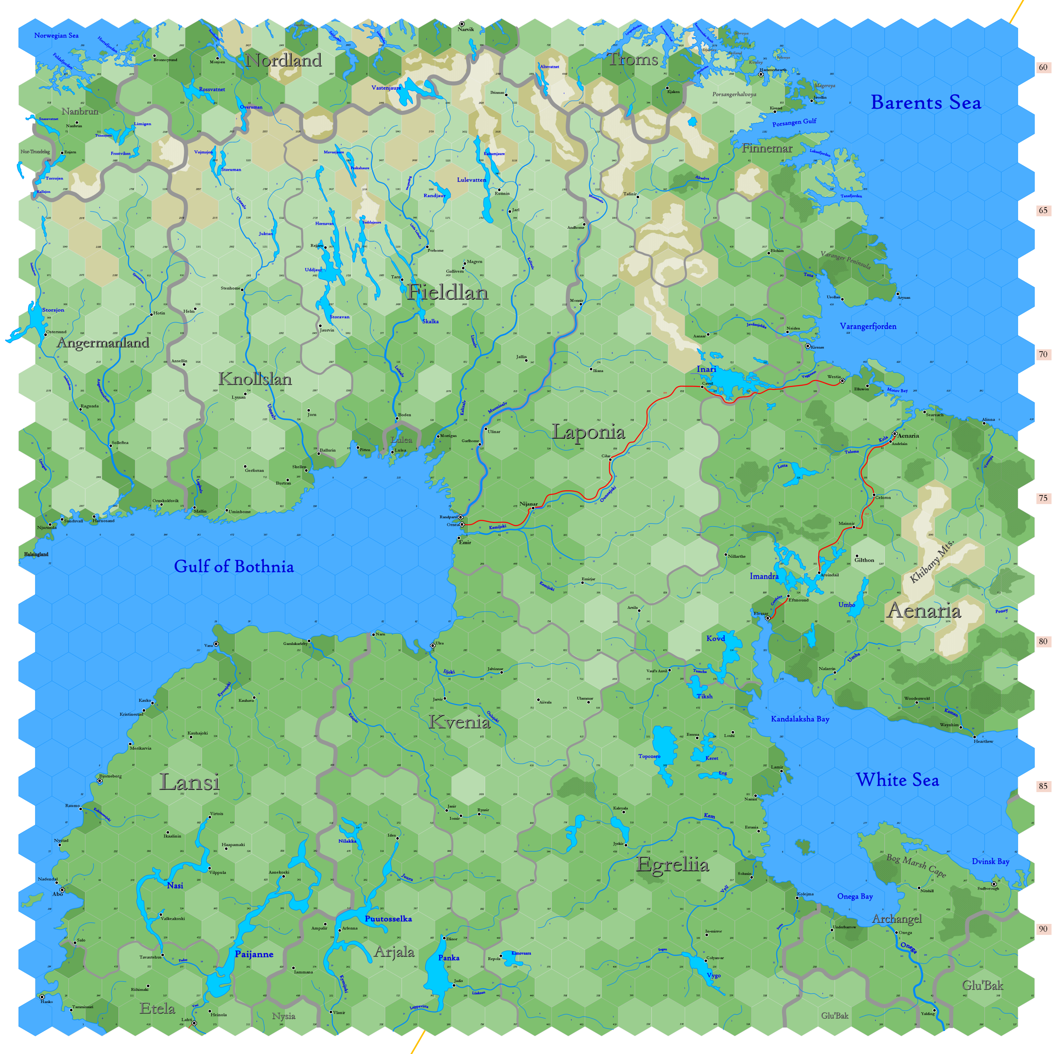
| + | Click to enlarge. Shows latitude 62.96° to 72.50° north; shows longitude at bottom of map between 14.19°E to 41.28°E. The orange line through the map indicates 30°E. Hexes are [[20-mile Hex Map|20 miles]] in diameter. Numbers at the right indicate distance from the north pole in hexes; the direction of north is at the top right, so it must be noted the direction on the map turns 60° at the 30th meridian. | ||
Revision as of 22:50, 12 March 2020
Click to enlarge. Shows latitude 62.96° to 72.50° north; shows longitude at bottom of map between 14.19°E to 41.28°E. The orange line through the map indicates 30°E. Hexes are 20 miles in diameter. Numbers at the right indicate distance from the north pole in hexes; the direction of north is at the top right, so it must be noted the direction on the map turns 60° at the 30th meridian.
