Difference between revisions of "Map A.10 - Bathurst"
From The Authentic D&D Wiki
Jump to navigationJump to searchTao alexis (talk | contribs) |
Tao alexis (talk | contribs) |
||
| Line 1: | Line 1: | ||
[[File:A.10 - Bathurst.png|760px|thumb]] | [[File:A.10 - Bathurst.png|760px|thumb]] | ||
| + | |||
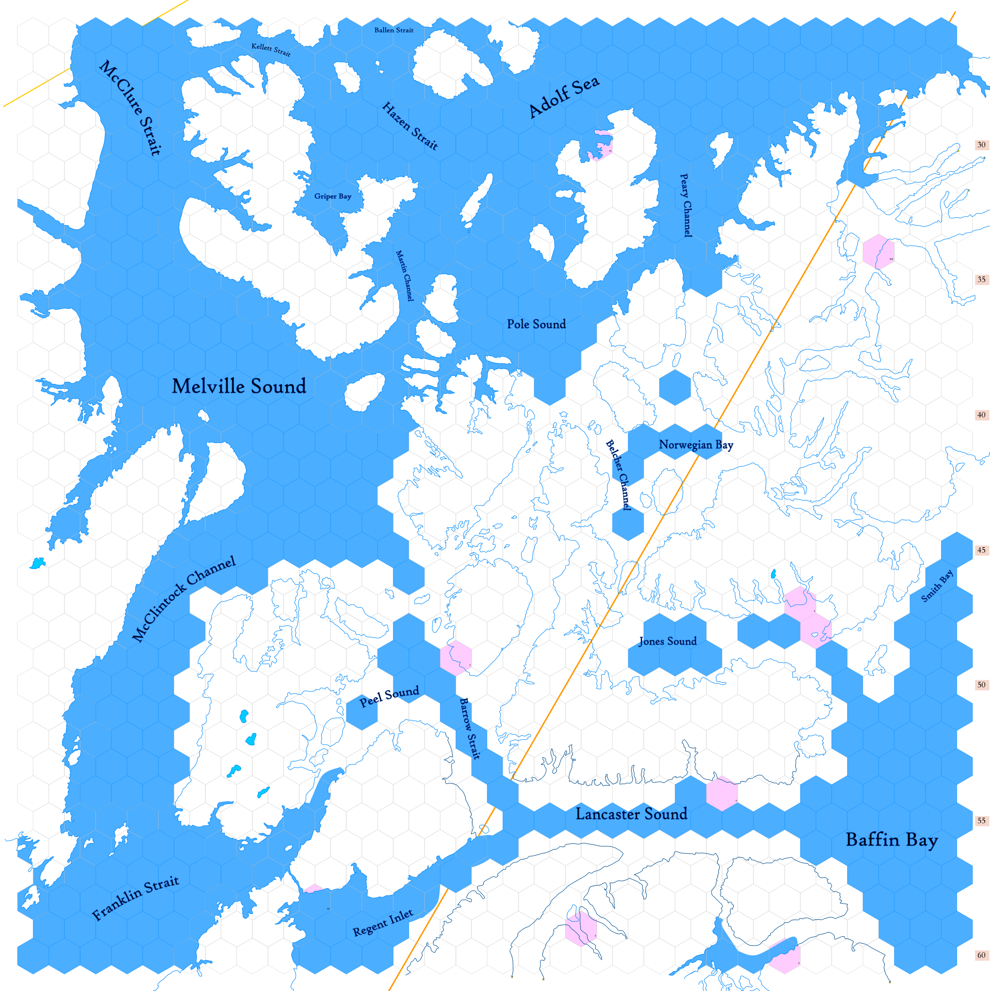
| + | Click to enlarge. Shows latitude 72.51 to 82.34 north, including islands from the Canadian [https://en.wikipedia.org/wiki/Arctic_Archipelago Arctic Archipelago], including [https://en.wikipedia.org/wiki/Melville_Island_(Northwest_Territories_and_Nunavut) Melville], Prince William, Somerset, [https://en.wikipedia.org/wiki/Bathurst_Island_(Canada) Bathurst], Devon, and [https://en.wikipedia.org/wiki/Axel_Heiberg_Island Axel Heiberg] islands, with parts of [https://en.wikipedia.org/wiki/Banks_Island Banks], [https://en.wikipedia.org/wiki/Victoria_Island_(Canada) Victoria], Baffin and [https://en.wikipedia.org/wiki/Ellesmere_Island Ellesmere] islands. | ||
Revision as of 02:50, 9 March 2020
Click to enlarge. Shows latitude 72.51 to 82.34 north, including islands from the Canadian Arctic Archipelago, including Melville, Prince William, Somerset, Bathurst, Devon, and Axel Heiberg islands, with parts of Banks, Victoria, Baffin and Ellesmere islands.
