From The Authentic D&D Wiki
Jump to navigationJump to search
|
|
| Line 1: |
Line 1: |
| | [[File:A.02 - East Svalbard.png|680px|thumb]] | | [[File:A.02 - East Svalbard.png|680px|thumb]] |
| − |
| |
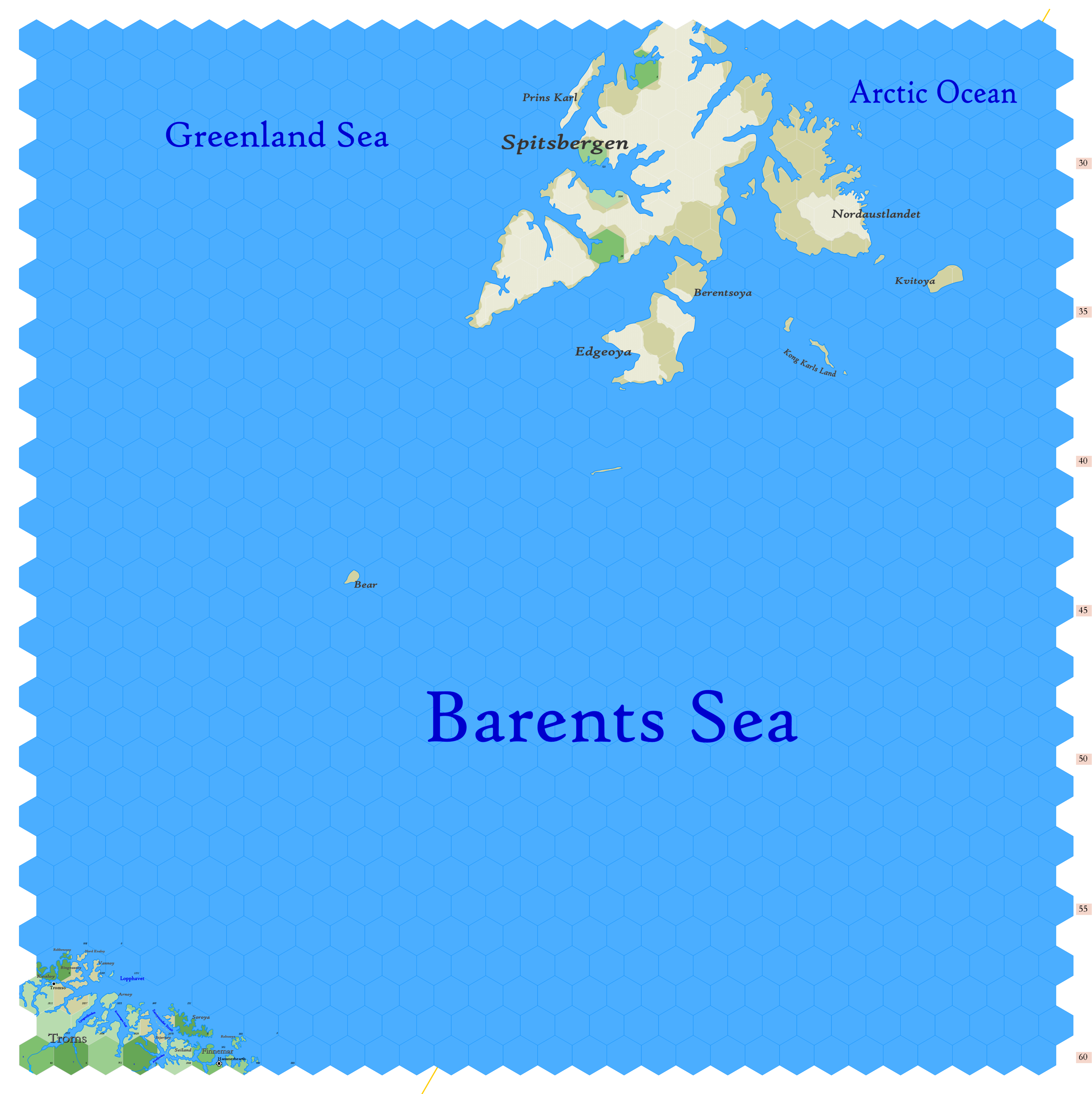
| − | Click to enlarge. Shows latitude 72.51 to 82.34 north, including the islands of [https://en.wikipedia.org/wiki/Svalbard Svalbard], [https://en.wikipedia.org/wiki/Bear_Island_(Norway) Bear Island] and the edges of [[County of Troms|Troms]] and [[Thann of Finnemar|Finnemar]]. The wide [https://en.wikipedia.org/wiki/Barents_Sea Barents Sea], sometimes called the ''Devil's Dance Floor'' or the ''Devil's Jaw'', dominates the map.
| |
| − |
| |
| − | The County of Troms is part of Denmark & Norway, and is inhabited by humans, but the Thann of Finnemar is elvish and part of the Principality of Ulthua. An important elvish trading [[Town|town]], Hammerhearth, is a gateway to the Arctic. It was settled in 747 A.D.
| |
| − |
| |
| − | I'd be most likely to employ the map as a pathway to Svalbard, towards which the party would venture in search of obscure wisdom or perhaps seeking the wreck of a lost ship. Details of the residents on those islands are being withheld for the day when my players find a reason to go here. I've not yet had any party who spent any time on this map.
| |
| − |
| |
| − | The orange line, showing at the center bottom and top right, gives the line of hexes that indicates 30°E. Hexes are [[20-mile Hex Map|20 miles]] in diameter. Numbers at the right indicate distance from the north pole in hexes; the direction of north is at the top right, so it must be noted the direction on the map turns 60° at the 30th meridian.
| |
| − | <br>
| |
| − | <br>
| |
| − | See Also,<br>
| |
| − | [[Sheet Maps]]<br>
| |
| − | :East: [[Map A.03 - Jotunheim|Jotunheim]]<br>
| |
| − | :West: [[Map A.01 - Greenland Sea|Greenland Sea]]<br>
| |
| − | <br>
| |
| − | And from Wikipedia:
| |
| − | :[https://en.wikipedia.org/wiki/Spitsbergen Spitsbergen]
| |
Revision as of 21:28, 1 July 2021
